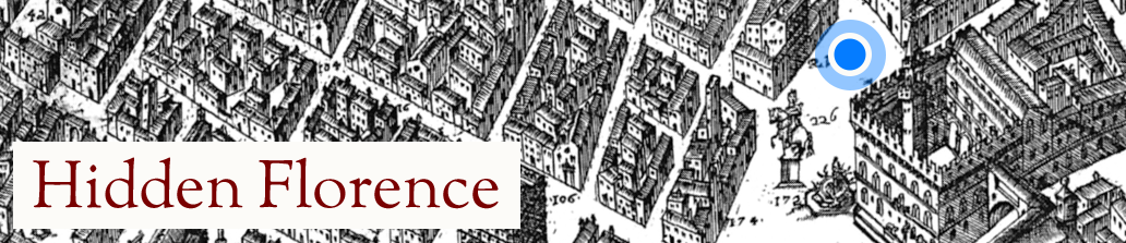
Not much is known about Stefano Bonsignori, the Benedictine monk who drafted the sizeable and largely accurate map that is used as the historic map in the Hidden Florence app. It is a remarkable piece of map-making as it combines a more traditional axonometric (“birds-eye view”) approach, with the innovative ichnographic (accurate figure ground) survey to offer the most accurate contemporary map of Florence in the sixteenth century. These two elements might be familiar to modern day users, as they combine features of the satellite and 3D views used in digital mapping tools like googlemaps. Thus the key network of streets stands out – and is indeed revealed to be quite similar to the modern layout in most areas – while landmarks are also prominent.
From January 1576 Bonsignori was employed by Grand Duke Francesco I de’ Medici to serve as court “cosmographer”; his main task was to complete a series of maps that make up the Sala delle Carte Geografiche in the ducal apartments of the Palazzo Vecchio, begun some years earlier by Egnazio Danti. It was during his tenure of the post as “cosmographer” that he produced two maps of the Florentine territories as well as the magnificent map of Florence, engraved in nine separate plates and assembled to create the huge map of 123 x 138 cm. Accuracy was certainly a key objective for the mapmaker as even its title indicates: “a new map of the beautiful and fair city of Florence accurately rendered” (Nova pulcherrimae civitatis Florentiae topographia accuratissime delineata).
Bonsignori was a monk in the local Tuscan branch of the Benedictine order, the Olivetians, and indeed the monastery on Monte Oliveto where he lived – raised up from the valley floor in which the city sits – to the south west of the walls is almost certainly the vantage point from which the view was compiled. A number of the scientific instruments that he used to survey Florence are now held in the Museo Galileo (the History of Science museum in Florence), including a solar quadrant with compass and three small portable sundials. You can actually see Bonsignori’s self portrait in the lower margin of the map, seated on a hill with his quadrant in hand. While Bonsignori made the survey and drew the map, it was engraved by the Florentine goldsmith Bonaventura Billocardo, with copies presented for the Grand Duke and his brother Cardinal Ferdinando de’ Medici (succeeded as Grand Duke 1588). Bonsignori died in 1589.
Fabrizio Nevola
Using the Map in the Hidden Florence App
Within the app, we wanted to be able to show the user their location on the historic Bonsignori map as well as on a more conventional, modern street map of Florence. That meant turning the original map image into a set of map tiles that could be selected and presented by the app as appropriate. We wanted to use three map zoom levels within the app to give the user both an overview of the neighbourhood and a detailed view of a few local streets. Fortunately, the historic map was of high enough resolution to provide such a zoomed-in view. However, that also meant that it contained lots of pixels and weighed in at 236MB. As that made the image difficult to manipulate as a whole, we worked instead with a version that had been cut up into 15 smaller sub-images.
We chose to create the historic tile sets just for the specific areas of Florence visited through the app. Having identified the bounds of each visit site, we found the corresponding Bonisignori sub-images and stitched them together in an image editor. Next we rotated, scaled and skewed the composite image in the editor until it lined up with a modern street map imported as a base layer. This was sometimes a challenge as we had to judge which surviving roads, bridges and buildings could be used as templates for matching the images. Fortunately many had! When the match was good, we discarded the modern map layer and exported the composite historic image. Finally, we geo-located that image by defining the latitude and longitude of its borders and cut it into 256-pixel tiles at zoom levels 17, 18 and 19. When added into the app, the end result is a historic Google-like map that provides an amazingly accurate representation of what would have been around the visitor in Bonsignori’s time.
Richard Hull
Further reading
General studies of Renaissance map making:
Hillary Ballon and David Friedman, ‘Portraying the City in Early Modern Europe: Measurement, Representation and Planning’, in The History of Cartography, vol. 3, Cartography in the European Renaissance, Part 1, ed. David Woodward, (Chicago: University of Chicago Press, 2007), 680-705
John A. Pinto, ‘Origins and Develolopment of the Ichnographic City Plan’, Journal of the Society of Architectural Historians, 35 (1976), 35-50
On Bonsignori and his map
Felicia Else, ‘Controlling the Waters of Granducal Florence: A New Look at Stefano Bonsignori’s View of the City (1584)’, Imago Mundi, 61 (2009), 168-85
Francesca Fiorani, The Marvel of Maps: Art, Cartography and Politics in Renaissance Italy (New Haven and London: Yale UP, 2005)
Thomas Frangenberg, ‘Chorographies of Florence: The Use of City Views and City Plans in the Sixteenth Century’, Imago Mundi, 46 (1994), 41-64.
Copyright notice
We are grateful to the Harvard College Library, Harvard University, for permission to use their copy of the map, reprinted in Rome in 1594.
Weblinks
http://brunelleschi.imss.fi.it/itineraries/itinerary/CartographyTuscany.html
http://www.stg.brown.edu/projects/florentine_gazetteer/map.php

One thought on “About Bonsignori’s map”
Comments are closed.